MISSION
A view from inside the industry
Air Axis was founded by sustainable energy industry experts, so we know the importance of inspections inside and out. Our goal is to leverage drone technology and make the process as efficient, exhaustive, and cost effective as possible. We know exactly what to look for—because we’ve been there.
OBJECTIVE
THE INTERSECTION OF INNOVATIVE TECH AND DETAILED ASSESSMENT
SERVICES
WE SUPPORT ALL TYPES OF PROJECTS AND INFRASTRUCTURES
We offer a comprehensive range of commercial drone services covering various applications. Our advanced drone fleet can conduct aerial inspections, monitor infrastructure, create maps, and provide surveillance, catering to diverse commercial needs.
INFRASTRUCTURE INSPECTION
Air Axis conducts aerial infrastructure inspections using drones equipped with optical zoom and thermal cameras. Services include one-time and recurring inspections for wind turbines, solar panels, buildings, and more. Optical zoom cameras provide detailed analysis, while thermal cameras detect temperature changes for applications such as insurance assessments, ensuring proactive maintenance.

SURVEILLANCE AND
MONITORING
We specialize in providing aerial surveillance services for various outdoor events, including concerts, sports, and conventions. Understanding the significance of public safety, especially in high-crime areas, we collaborate closely with local law enforcement and security teams to ensure a safe environment. Additionally, we excel in setting up and operating UAV systems remotely for highly sensitive areas requiring remote monitoring.
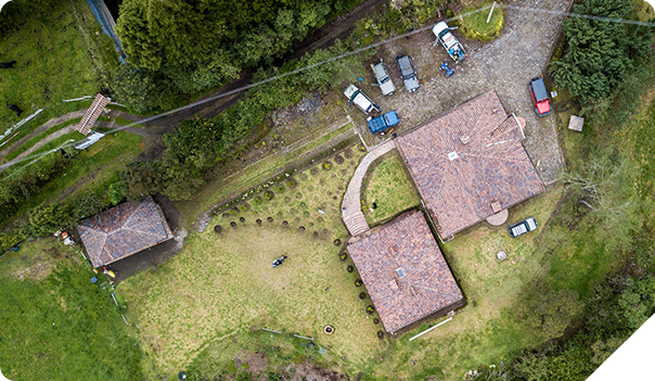
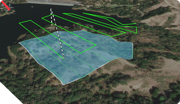
MAPPING AND SURVEYING
Our drone payloads boast advanced technology for generating 2D or 3D models through photogrammetry or LiDAR. Whether you require earthwork quantities for a new road or mapping for development, we streamline the process. We prioritize accurate mapping and quantities to ensure clarity and efficiency in planning and construction phases.
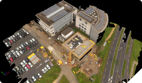
CONSTRUCTION
PROGRESS
DOCUMENTATION
Do you need to update your owner representative on construction progress monthly? Air Axis ensures timely visits to your site, documenting various processes. We prioritize delivering high-quality portfolios and presentations for your use. Additionally, we assist in leveraging these assets for educational and marketing purposes alongside construction updates.